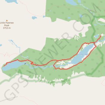
Lake Isabelle and Long Lake Loop
Interactive trail map
Trail profile
- Distance: 8.9 Km
- Elevation gain: 222 m
- Maximum elevation: 3,348 m
- Elevation loss: 222 m
- Minimum elevation: 3,205 m
About this trail
Name: Lake Isabelle and Long Lake Loop trail, distance, elevation, map, profile, GPS track
Coordinates: 40.06790 -105.62242 40.07787 -105.58446
Other hiking, mountain biking, running and outdoor activity trails
Click on a trail to view its statistics, map and profile.
Lone Eagle Peak - Pawnee Pass
United States > Colorado > Grand County
From the Lake Granby side, this traverse begins near Monarch Lake and follows the Cascade Creek corridor into the Indian Peaks Wilderness, passing forested shoreline, Arapaho Pass Trail junction, Buchanan Creek, Cascade Creek, and waterfall-lined sections of the valley. Beyond the Cascade Creek basin, the…
Distance: 32.9 Km • Elevation gain: 2,006 m • Maximum elevation: 3,824 m
Lake Isabelle, Long Lake, and Brainard Lake Loop in Indian Peaks Wilderness
United States > Colorado > Boulder County
The Lake Isabelle, Long Lake, and Brainard Lake Loop in Colorado's Indian Peaks Wilderness offers hikers a journey through diverse landscapes, including wildflower meadows, subalpine forests, and mountain vistas. Along the trail, one can observe Long Lake and Lake Isabelle, both set against a backdrop of…
Distance: 10.1 Km • Elevation gain: 238 m • Maximum elevation: 3,339 m