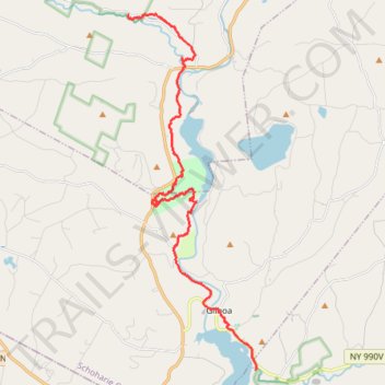
Long Path
- Distance: 21.3 Km
- Elevation gain: 625 m
- Maximum elevation: 386 m
- Elevation loss: 578 m
- Minimum elevation: 245 m
- Moving time: 3 h 47 m
- Moving speed: 5.6 Km/h
- Maximum speed: 12.2 Km/h
- Total time: 3 h 58 m
- Global speed: 5.4 Km/h
Interactive trail map
Trail profile
- Distance: 21.3 Km
- Elevation gain: 625 m
- Maximum elevation: 386 m
- Elevation loss: 578 m
- Minimum elevation: 245 m
- Moving time: 3 h 47 m
- Moving speed: 5.6 Km/h
- Maximum speed: 12.2 Km/h
- Total time: 3 h 58 m
- Global speed: 5.4 Km/h
About this trail
Name: Long Path trail, distance, elevation, map, profile, GPS track
Start: Long Path, Town of Blenheim, Schoharie County, New York, 12131, United States (42.48395 -74.48193)
Coordinates: 42.37959 -74.48204 42.48425 -74.43099
Other hiking, mountain biking, running and outdoor activity trails
Click on a trail to view its statistics, map and profile.
Mine Kill Falls via Orange Trail
United States > New York > Schoharie County
Distance: 4.4 Km • Elevation gain: 161 m • Maximum elevation: 375 m