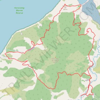
Horoirangi / Drumduan Loop via Cable Bay Walkway and Overlook
- Distance: 25.7 Km
- Elevation gain: 1,488 m
- Maximum elevation: 408 m
- Elevation loss: 1,487 m
- Minimum elevation: 8 m
- Moving time: 4 h 47 m
- Moving speed: 5.4 Km/h
- Maximum speed: 16.7 Km/h
- Total time: 5 h 16 m
- Global speed: 4.9 Km/h
Interactive trail map
Trail profile
- Distance: 25.7 Km
- Elevation gain: 1,488 m
- Maximum elevation: 408 m
- Elevation loss: 1,487 m
- Minimum elevation: 8 m
- Moving time: 4 h 47 m
- Moving speed: 5.4 Km/h
- Maximum speed: 16.7 Km/h
- Total time: 5 h 16 m
- Global speed: 4.9 Km/h
About this trail
Name: Horoirangi / Drumduan Loop via Cable Bay Walkway and Overlook trail, distance, elevation, map, profile, GPS track
Start: 194, Cable Bay Road, Hira, Nelson, New Zealand (-41.20175 173.41328)
End: 194, Cable Bay Road, Hira, Nelson, New Zealand (-41.20174 173.41321)
Coordinates: -41.20193 173.36732 -41.15989 173.42210
Topography: Nelson topographic map, elevation, terrain