Tracked with OSMTracker for Android™
walking
- Distance: 7.0 Km
- Elevation gain: 191 m
- Maximum elevation: 512 m
- Elevation loss: 198 m
- Minimum elevation: 386 m
- Moving time: 1 h 53 m
- Moving speed: 3.7 Km/h
- Maximum speed: 21.4 Km/h
- Total time: 1 h 59 m
- Global speed: 3.5 Km/h
Interactive trail map
Trail profile
- Distance: 7.0 Km
- Elevation gain: 191 m
- Maximum elevation: 512 m
- Elevation loss: 198 m
- Minimum elevation: 386 m
- Moving time: 1 h 53 m
- Moving speed: 3.7 Km/h
- Maximum speed: 21.4 Km/h
- Total time: 1 h 59 m
- Global speed: 3.5 Km/h
About this trail
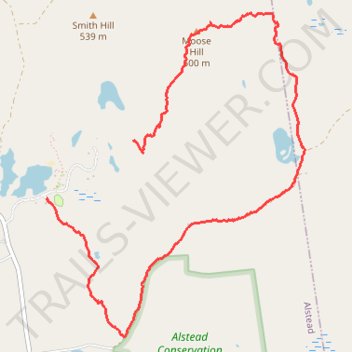
Name: Tracked with OSMTracker for Android™ trail, distance, elevation, map, profile, GPS track
End: 6, Middle Way, Alstead, Cheshire County, New Hampshire, 03448, United States (43.08560 -72.26949)
Coordinates: 43.07628 -72.26957 43.09819 -72.24582
Other hiking, mountain biking, running and outdoor activity trails
Click on a trail to view its statistics, map and profile.