
2026-10-23 13:22:25
- Distance: 8.4 Km
- Elevation gain: 15 m
- Maximum elevation: 59 m
- Elevation loss: 16 m
- Minimum elevation: 53 m
- Moving time: 2 h 20 m
- Moving speed: 3.6 Km/h
- Maximum speed: 7.2 Km/h
- Total time: 4 h 47 m
- Global speed: 1.8 Km/h
Interactive trail map
Trail profile
- Distance: 8.4 Km
- Elevation gain: 15 m
- Maximum elevation: 59 m
- Elevation loss: 16 m
- Minimum elevation: 53 m
- Moving time: 2 h 20 m
- Moving speed: 3.6 Km/h
- Maximum speed: 7.2 Km/h
- Total time: 4 h 47 m
- Global speed: 1.8 Km/h
About this trail
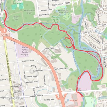
Name: 2026-10-23 13:22:25 trail, distance, elevation, map, profile, GPS track
Coordinates: 40.96829 -74.29770 40.98209 -74.27694
Other hiking, mountain biking, running and outdoor activity trails
Click on a trail to view its statistics, map and profile.

Trace of the completed Pompton Valley Rail Trail in Pompton Plains, NJ
United States > New Jersey > Morris County > Pequannock Township
Distance: 16.7 Km • Elevation gain: 57 m • Maximum elevation: 62 m