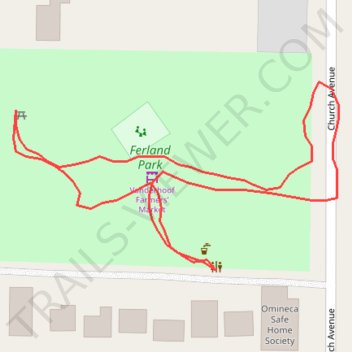
Ferland Park
- Distance: 0.5 Km
- Elevation gain: 3 m
- Maximum elevation: 642 m
- Elevation loss: 3 m
- Minimum elevation: 639 m
- Moving time: 8 m 16 s
- Moving speed: 3.8 Km/h
- Maximum speed: 7.4 Km/h
- Total time: 12 m 16 s
- Global speed: 2.6 Km/h
Interactive trail map
Trail profile
- Distance: 0.5 Km
- Elevation gain: 3 m
- Maximum elevation: 642 m
- Elevation loss: 3 m
- Minimum elevation: 639 m
- Moving time: 8 m 16 s
- Moving speed: 3.8 Km/h
- Maximum speed: 7.4 Km/h
- Total time: 12 m 16 s
- Global speed: 2.6 Km/h
About this trail
Name: Ferland Park trail, distance, elevation, map, profile, GPS track
Coordinates: 54.01744 -124.01357 54.01817 -124.01142