
West Coast trails
Click on a trail to view its statistics, map and profile.

Bella Coola - Snooka trail - west
Canada > British Columbia > Central Coast Regional District > Area D (East Bella Coola)
Bella coola, bc
Distance: 5.2 Km • Elevation gain: 226 m • Maximum elevation: 212 m

Hall Canyon
United States > California > Ventura County > San Buenaventura (Ventura)
From Hall Canyon Road, the route enters Ventura Hills Nature Preserve and follows the quiet canyon corridor between open foothill slopes. It continues along dry washes and coastal scrub typical of Ventura’s protected hillside landscape. The walk reaches the split between West Fork Hall Canyon and East Fork…
Distance: 7.5 Km • Elevation gain: 193 m • Maximum elevation: 131 m
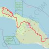
Trans Catalina Trail (TCT)
United States > California > Los Angeles County > Avalon > Pebbly Beach
The Trans-Catalina Trail begins in Avalon, leaving the island’s lively harbor town to climb into the dry, rugged interior of Santa Catalina Island. The route passes Haypress Reservoir and Cape Canyon Reservoir before entering the Black Jack backcountry and continuing toward Catalina Airport, often known as…
Distance: 62.3 Km • Elevation gain: 2,826 m • Maximum elevation: 531 m

Sea Lion Caves
Canada > British Columbia > Capital Regional District > Juan de Fuca Electoral Area
Juan de Fuca Park. Vancouver Island. #Hiking #JuanDeFuca #Vancouver
Distance: 5.9 Km • Elevation gain: 340 m • Maximum elevation: 196 m

Norfolk Coast Path - Cley to Cromer
United Kingdom > England > Norfolk > North Norfolk > Cley next the Sea
norfolk-coast-path, cley-next-the-sea, weybourne, sheringham, west-runton, east-runton, cromer
Distance: 20.1 Km • Elevation gain: 282 m • Maximum elevation: 43 m

Redwood Regional Park Loop
United States > California > Alameda County
Starting at Canyon Meadow, this Redwood Regional Park loop follows the Stream Trail into the cool corridor of Redwood Creek, passing picnic clearings before entering the shaded coast-redwood forest that gives the park its character. Beyond the creekside section, the route climbs onto the French Trail,…
Distance: 10.2 Km • Elevation gain: 425 m • Maximum elevation: 465 m

West Coast Trail (Vancouver Island)
Canada > British Columbia > Cowichan Valley Regional District > Area F (Cowichan Lake South / Skutz Falls)
Hike along the West Coast Trail via Camper Bay, Cullite Cove, Logan Creek Bridge, Wallbran Creek Camp, Bonilla Creek, Carmanah Creek Camp, Cribs Creek Camp, Dare Point, Nitinat River, Tsuquadra Point Camp, Tsusiat Falls, Klanawa River, Tsocowis Creek Camp, Darling River Camp, Michigan Creek Camp, Pachena Point…
Distance: 68.6 Km • Elevation gain: 1,832 m • Maximum elevation: 123 m

Globe Hill Loop Ride via Lookout Trail, Globe Hill Trail, Fossickers Lake Trail, Alborns Mine Trail and Soldiers - Big River Road from Reefton
New Zealand > West Coast > Buller District > Reefton
◾️ 25, July Training status ◾️ 😄 Gradually improving (401) 🌳 Fitness 62, Fatigue 62, Balance 0 ◾️ Ride Summary ◾️ 🐶 Free Training (moderate intensity) 🏷️ Motivational effect, Sustained, Amused 🚵 Hillclimb Ride 📊 RP 149, Int 0.59, Vol 106 ✨ Recovery time 30 hour…
Distance: 34.4 Km • Elevation gain: 1,214 m • Maximum elevation: 628 m

Mount Umunhum
United States > California > Santa Clara County > Peckham Ranch
Starting at Bald Mountain Parking Area in Sierra Azul Open Space Preserve, the route follows Mount Umunhum Trail westward through mixed chaparral, knobcone pine, coast live oak, California bay, and madrone, with openings toward Santa Clara Valley and the surrounding ridges. The itinerary then passes the…
Distance: 12.1 Km • Elevation gain: 633 m • Maximum elevation: 1,046 m

Kawatiri Coastal Trail from Westport to Charleston
New Zealand > West Coast > Buller District
Distance: 41.9 Km • Elevation gain: 376 m • Maximum elevation: 53 m

Henry Hudson Trail
United States > New Jersey > Monmouth County > Aberdeen Township
This ride follows the Henry Hudson Trail’s northern Bayshore rail corridor from the Aberdeen–Keyport edge, leaving the busy rail-and-parkway setting for a flat, paved, mostly tree-lined greenway through suburban streets, creeks, wetlands and neighborhood parkland. From west to east, the route passes…
Distance: 15.6 Km • Elevation gain: 42 m • Maximum elevation: 14 m

Arch Rock Loop via Glen Trail, Coast Trail and Bear Valley Trail
United States > California > Marin County
Starting from Glen Campground, this loop leaves the quiet backcountry camp area on the Glen Trail, crossing wooded ridges, small drainages, coastal scrub and open grassy slopes before bending westward toward the exposed Pacific side of Point Reyes National Seashore. The route then follows the Coast Trail…
Distance: 9.6 Km • Elevation gain: 347 m • Maximum elevation: 245 m

West Ridge, French and Stream Trails Loop
United States > California > Contra Costa County
From Skyline Gate, the loop first follows West Ridge Trail along the higher western edge of Reinhardt Redwood Regional Park, with evergreen woodland, chaparral openings, and views over the forested Redwood Creek basin. It then turns onto French Trail, crossing the quieter interior slopes past side-trail…
Distance: 7.3 Km • Elevation gain: 344 m • Maximum elevation: 407 m

West Ridge, French and Stream Trails Loop in Reinhardt Redwood Regional Park
United States > California > Contra Costa County
The West Ridge, French, and Stream Trails Loop in Reinhardt Redwood Regional Park offers hikers a serene journey through towering coast redwoods, providing ample shade and a tranquil atmosphere. As you navigate the well-marked paths, you'll encounter diverse flora, including ferns and wildflowers, and may spot…
Distance: 7.8 Km • Elevation gain: 402 m • Maximum elevation: 409 m


Hunstanton to Kings Lynn
United Kingdom > England > Norfolk > King's Lynn and West Norfolk > Hunstanton
Norfolk Coast Path/England Coast Path
Distance: 31.2 Km • Elevation gain: 90 m • Maximum elevation: 25 m

Cape Falcon Trail in Oswald West State Park
United States > Oregon > Tillamook County
The Cape Falcon Trail in Oswald West State Park offers hikers a journey through lush old-growth forests, leading to a headland with panoramic views of the Pacific Ocean, with sights extending southward to Neahkahnie Mountain. Along the way, the trail provides glimpses of Short Sand Beach, a popular spot for…
Distance: 7.3 Km • Elevation gain: 338 m • Maximum elevation: 100 m


Norfolk Coast Path - King's Lynn to Dersingham
United Kingdom > England > Norfolk > King's Lynn and West Norfolk > King's Lynn
Distance: 21.0 Km • Elevation gain: 54 m • Maximum elevation: 14 m

Jacobsbaai Loop
South Africa > Western Cape > West Coast District Municipality > Saldanha Bay Local Municipality > Jacobsbaai
Distance: 4.9 Km • Elevation gain: 30 m • Maximum elevation: 17 m

Seeberg Viewpoint Loop Hike
South Africa > Western Cape > West Coast District Municipality > Saldanha Bay Local Municipality > Langebaan
Distance: 6.2 Km • Elevation gain: 138 m • Maximum elevation: 132 m

Sugar Bag Road Town Reserve Mountain Biking
Australia > Queensland > Sunshine Coast Regional
Most of the trails #MTB
Distance: 15.1 Km • Elevation gain: 231 m • Maximum elevation: 54 m


Copland Track to Welcome Flat Hut
New Zealand > West Coast > Westland District
Distance: 17.5 Km • Elevation gain: 835 m • Maximum elevation: 481 m

Rainbow Range Trail
Canada > British Columbia > Cariboo Regional District > Area J (West Chilcotin)
Distance: 9.4 Km • Elevation gain: 49 m • Maximum elevation: 1,866 m


Norfolk Coast Path - Dersingham to Hunstanton
United Kingdom > England > Norfolk > King's Lynn and West Norfolk > Dersingham
Distance: 18.4 Km • Elevation gain: 59 m • Maximum elevation: 24 m

Murchison - Reefton
#Bike
Distance: 122.2 Km • Elevation gain: 1,826 m • Maximum elevation: 689 m

Norfolk Coast Path - Hunstanton to Brancaster Staithe
United Kingdom > England > Norfolk > King's Lynn and West Norfolk > Hunstanton > Old Hunstanton
Distance: 18.5 Km • Elevation gain: 113 m • Maximum elevation: 57 m

Globe-Progress Gold Mine Loop MTB from Reefton via Zig Zag Track, Globe Hill Trail and Soldiers - Big River Road
New Zealand > West Coast > Buller District
Distance: 24.6 Km • Elevation gain: 957 m • Maximum elevation: 628 m


The Wash National Nature Reserve
United Kingdom > England > Norfolk > King's Lynn and West Norfolk > West Lynn
walking, norfolk-coast-path, west-lynn
Distance: 21.1 Km • Elevation gain: 61 m • Maximum elevation: 6 m


Pembrokeshire Coast from Tenby to Trewent Park
United Kingdom > Wales > Pembrokeshire > Tenby
Via North Beach, South Beach, Giltar Point, Valleyfield Top, Proud Giltar, Lydstep Haven Beach, Skrinkle Haven, Priests Nose, Manorbier Beach, East Moor Cliff, West Moor Cliff and Freshwater East.
Distance: 19.9 Km • Elevation gain: 583 m • Maximum elevation: 70 m


Hike to Claire Lake
Canada > British Columbia > Sunshine Coast Regional District > Area F (West Howe Sound) > Port Mellon
Distance: 20.3 Km • Elevation gain: 1,059 m • Maximum elevation: 996 m

Hokitika Gorge Walkway
New Zealand > West Coast > Westland District
Distance: 2.2 Km • Elevation gain: 63 m • Maximum elevation: 115 m

High Steenberg via Wolfkop
South Africa > Western Cape > City of Cape Town
This relatively easy hike begins with a short but steep, unexposed scramble up to Wolfkop. From there, you follow a circular route that takes you past Steenberg Peak with panoramic views of the surrounding mountains, valleys, and the coastline in the distance.
Distance: 3.5 Km • Elevation gain: 241 m • Maximum elevation: 535 m

England Coast Path Westwards from Nacton Shore
United Kingdom > England > Suffolk > Ipswich > Nacton
Distance: 4.9 Km • Elevation gain: 49 m • Maximum elevation: 18 m

Horsey and Winterton Loop Walk
United Kingdom > England > Norfolk > North Norfolk > Horsey
Northfolk Coast National Landscape walking, horsey, winterton, winterton-on-sea, west-somerton
Distance: 14.8 Km • Elevation gain: 33 m • Maximum elevation: 9 m

Kawatiri Coastal Trail from Charleston to Westport
New Zealand > West Coast > Buller District > Charleston
Distance: 41.9 Km • Elevation gain: 363 m • Maximum elevation: 53 m

Walpole-Nornalup National Park MTB Loop
Australia > Western Australia > Walpole
Distance: 64.5 Km • Elevation gain: 1,200 m • Maximum elevation: 204 m

Angle to Pembroke - Wales Coast Path (WCP)
United Kingdom > Wales > Pembrokeshire > Angle
Distance: 18.5 Km • Elevation gain: 308 m • Maximum elevation: 63 m

Lake Brunner Scenic Trail
New Zealand > West Coast > Grey District > Moana
Distance: 19.4 Km • Elevation gain: 188 m • Maximum elevation: 112 m

Paparoa Track and Pike 29
New Zealand > West Coast > Buller District > Punakaiki
Cycling
Distance: 69.2 Km • Elevation gain: 2,428 m • Maximum elevation: 1,066 m

Hike on Mount Elphinstone
Canada > British Columbia > Sunshine Coast Regional District > Area F (West Howe Sound) > Langdale
Distance: 11.7 Km • Elevation gain: 1,145 m • Maximum elevation: 1,241 m

Gambier Island
Canada > British Columbia > Sunshine Coast Regional District > Area F (West Howe Sound)
A walk in the woods
Distance: 18.1 Km • Elevation gain: 872 m • Maximum elevation: 522 m

Walking Track behind race course
New Zealand > West Coast > Westland District > Hokitika
Distance: 2.3 Km • Elevation gain: 4 m • Maximum elevation: 63 m

To Pfeifer Bivouac
New Zealand > West Coast > Westland District
Distance: 8.4 Km • Elevation gain: 1,253 m • Maximum elevation: 1,475 m

Hel se Pad Pass
South Africa > Western Cape > West Coast District Municipality > Matzikama Local Municipality
Distance: 16.7 Km • Elevation gain: 580 m • Maximum elevation: 804 m

Gifboom Loop Trail
South Africa > Western Cape > West Coast District Municipality > Matzikama Local Municipality
Distance: 7.8 Km • Elevation gain: 267 m • Maximum elevation: 535 m