
Upper Village trails
Click on a trail to view its statistics, map and profile.
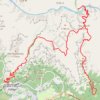
South Kaibab - Tonto - Bright Angel (Grand Canyon)
United States > Arizona > Coconino County
From Yaki Point, the route commits at once to the exposed descent of the South Kaibab Trail, a dramatic ridgeline path known for wide, open views and very little shade or water. It first reaches Ooh Aah Point, where the canyon opens suddenly in every direction, then continues through the sculpted upper…
Distance: 30.1 Km • Elevation gain: 2,293 m • Maximum elevation: 2,217 m
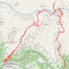
Grand Canyon Rim to River
United States > Arizona > Coconino County
From the South Kaibab Trailhead, this rim-to-river route immediately commits to one of the Grand Canyon’s most open and scenic descents, following a ridgeline where the canyon unfolds in wide layers of buttes, cliffs and side canyons. The trail passes Ooh Aah Point, Cedar Ridge, Skeleton Point and The Tipoff…
Distance: 27.3 Km • Elevation gain: 2,243 m • Maximum elevation: 2,201 m
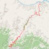
Pipe Creek Beach via Bright Angel Trail
United States > Arizona > Coconino County > Grand Canyon Village
From Grand Canyon Village on the South Rim, this route begins at the Bright Angel Trailhead and descends beneath the rim through a dramatic chain of switchbacks, with widening views across the canyon walls and the layered cliffs of the Bright Angel fault corridor. It passes the resthouse section of the upper…
Distance: 25.2 Km • Elevation gain: 2,225 m • Maximum elevation: 2,085 m
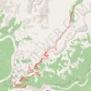
Indian Garden (Grand Canyon)
United States > Arizona > Coconino County > Grand Canyon Village
From Grand Canyon Village on the South Rim, the route drops onto the Bright Angel Trail, passing the rim-side trailhead, the upper tunnel, Mallery’s Grotto pictographs, and the second tunnel as the path enters a shaded side canyon framed by high cliffs. The descent continues through long switchbacks and…
Distance: 7.5 Km • Elevation gain: 339 m • Maximum elevation: 2,085 m
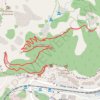
1.5 Mile Resthouse (Grand Canyon)
United States > Arizona > Coconino County > Grand Canyon Village
From Grand Canyon Village, the route leaves the rim near Bright Angel Lodge and drops onto the Bright Angel Trail, quickly entering the shaded upper canyon through tight switchbacks and broad South Rim viewpoints. The path continues across pale cliffs, wooded pockets and exposed canyon slopes, following one of…
Distance: 2.6 Km • Elevation gain: 192 m • Maximum elevation: 2,085 m
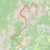
Upper Yosemite Fall, Yosemite Point, Oh My Gosh Point and Columbia Rock
United States > California > Mariposa County > Yosemite Village > Yosemite Lodge
Starting near Yosemite Lodge and the Camp Four area, this demanding route climbs the Upper Yosemite Fall Trail through oak woodland and granite switchbacks, quickly rising above Yosemite Valley toward Columbia Rock, where broad views open over the valley floor, Merced River corridor, Half Dome, and surrounding…
Distance: 14.9 Km • Elevation gain: 2,437 m • Maximum elevation: 2,143 m
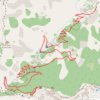
3 Mile Resthouse (Grand Canyon)
United States > Arizona > Coconino County > Grand Canyon Village
From Grand Canyon Village, the route leaves the South Rim at the Bright Angel Trailhead near the historic rim area and drops onto the Bright Angel Trail, one of the park’s classic corridor trails, used through time by Indigenous peoples, miners, early tourists, hikers, and mule parties. The descent quickly…
Distance: 4.8 Km • Elevation gain: 262 m • Maximum elevation: 2,085 m
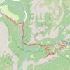
Vernal Fall and Clark Point Loop
United States > California > Mariposa County > Curry Village
The route follows the river upstream toward the waterfall approach, passing through a lively canyon setting shaped by clear pools, polished rock and constant movement from the Merced. The hike then joins the Mist Trail, where the scenery becomes more dramatic beneath Vernal Fall, with spray, stone steps, cliff…
Distance: 9.4 Km • Elevation gain: 806 m • Maximum elevation: 1,699 m
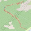
Columbia Rock
United States > California > Mariposa County > Yosemite Village > Yosemite Lodge
From the Yosemite Valley near Camp Four, the Upper Yosemite Fall Trail climbs steadily into the forest, following a long series of switchbacks above the valley floor. The route reaches Columbia Rock, a rocky overlook with a broad panorama over Yosemite Valley, Half Dome, Sentinel Rock and the surrounding…
Distance: 1.6 Km • Elevation gain: 357 m • Maximum elevation: 1,531 m
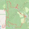
Grant Grove Village to Sequoia Lake Loop
United States > California > Tulare County > Grant Grove Village
Loop hike from Grant Grove Village to Sequoia Lake via Sunset Trail, Ella Falls, Dead Giant Loop Trail, Sequoia Lake Overlook, North Grove Trail, Centennial Stump, General Grant Tree, Tennessee Tree, Michigan Tree and South Boundary Trail in the Kings Canyon National Park and the Giant Sequoia National Forest.…
Distance: 17.5 Km • Elevation gain: 643 m • Maximum elevation: 2,023 m
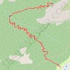
Columbia Rock Trail via Upper Yosemite Fall Trail in Yosemite National Park
United States > California > Mariposa County > Yosemite Village > Yosemite Lodge
The Columbia Rock Trail, accessible via the Upper Yosemite Fall Trail, offers hikers a rewarding ascent through oak woodlands and granite switchbacks. Upon reaching Columbia Rock, you're greeted with panoramic views of Yosemite Valley, including iconic landmarks like Half Dome and Sentinel Rock. For those…
Distance: 3.1 Km • Elevation gain: 369 m • Maximum elevation: 1,531 m
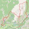
Yosemite North Dome Loop
United States > California > Mariposa County > Curry Village
Loop hike to North Dome via Lower Mirror Lake, Tenaya Creek, Valley Loop Trail, Snow Creek Trail, North Dome Trail, Upper Yosemite Fall Trail, Oh My Gosh Point and Columbia Rock in the Yosemite National Park. #Hiking #Loop #Mountain #Nature #Lake #Forest #Fall #Park #Yosemite
Distance: 32.0 Km • Elevation gain: 2,275 m • Maximum elevation: 2,484 m
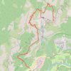
Yosemite Point via Upper Yosemite Fall Trail in Yosemite National Park
United States > California > Mariposa County > Yosemite Lodge
The Upper Yosemite Falls Trail to Yosemite Point is a strenuous hike that offers hikers panoramic views of Yosemite Valley, including iconic landmarks such as Half Dome and the Cathedral Spires. Along the ascent, the trail provides close-up perspectives of the majestic Upper Yosemite Falls—one of the tallest…
Distance: 13.8 Km • Elevation gain: 1,775 m • Maximum elevation: 2,138 m
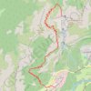
Upper Yosemite Fall Trail in Yosemite National Park
United States > California > Mariposa County > Yosemite Village > Yosemite Lodge
The Upper Yosemite Fall Trail is a demanding hike that rewards adventurers with breathtaking panoramic views of Yosemite Valley, Half Dome, and the mighty Yosemite Falls. As you ascend, you'll pass through diverse terrain, from oak forests and steep switchbacks to open sections offering sweeping vistas. The…
Distance: 10.2 Km • Elevation gain: 1,501 m • Maximum elevation: 2,039 m
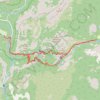
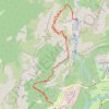
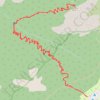
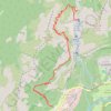
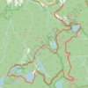
Black Rock Forest: Upper Reservoir, Aleck Meadow Reservoir, Sphagnum Pond, Tamarack Pond, Arthus Pond, Bog Meadow Pond, Rattlesnake Hill and Hill of Pines loop
United States > New York > Orange County > Town of Cornwall > Village of Cornwall-on-Hudson
Morning Loop Run
Distance: 13.6 Km • Elevation gain: 372 m • Maximum elevation: 415 m
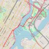
Morning Run
United States > New York > New York County > New York
Distance: 13.7 Km • Elevation gain: 158 m • Maximum elevation: 34 m